
Handwritten in Stone
9 October 2015 – 31 January 2016
Today sees the opening of our new special exhibition – Handwritten in Stone – celebrating the life and work of William Smith on the bicentenary of his publication of the first geological map of England and Wales.
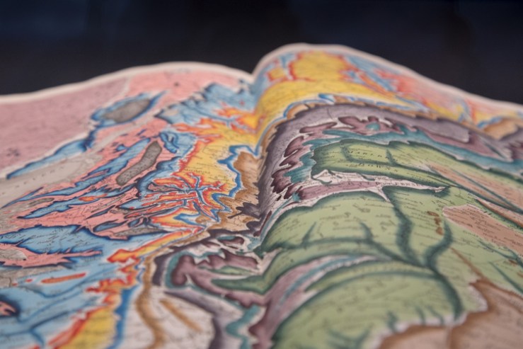
Dubbed ‘The Map that Changed the World’ in Simon Winchester’s book of that title, the beautifully hand-coloured map revealed a three-dimensional arrangement of rock layers, or strata, along with a fourth dimension – time.
This work earned Smith the moniker ‘the father of geology’, an accomplishment all the more impressive given that Smith achieved it single-handedly and with very little formal education.
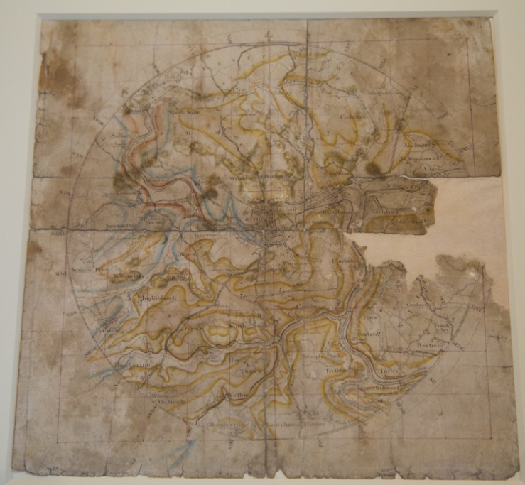
The Museum holds the largest archive of Smith material in the world. Alongside the famous 1815 map, shown at the top of the article, are personal papers, drawings, publications, maps and geological sections, most of which are being displayed for the first time. With these we have some fossil material from the collections: Smith realised that particular combinations of fossils were unique to different rock formations and could be used to date the strata.

Handwritten in Stone, supported by the Heritage Lottery Fund, is the first show in our new special exhibition gallery on the upper east side of the building. Working out how to use the space was a learning process, and the final, elegant design is the work of local consultancy Giraffe Corner.
To bring the final exhibition together we collaborated with writer Rebecca Mileham, an installation team from the Ashmolean Museum, and more than 50 volunteers. Look out for more about the volunteers’ contributions on this blog soon.
The 1815 map itself takes centre-stage in the exhibition, flanked on one side by the history of Smith’s work building up to its publication, and on the other by the legacy of his techniques, which are still used today.
To discover the full story of William ‘Strata’ Smith head over to the upper east side of the Museum before 31 January.
And don’t forget to look out for our What’s On programme which includes lots of William Smith and geology-focused events, including a public talk by author Simon Winchester on 13 October.
Scott Billings – Public engagement officer

[…] anniversary of the publication of William Smith’s Geological Map, which we are celebrating with our current exhibition Handwritten in Stone. Smith also went on to conceive and design the The Rotunda Museum as the ideal place to display […]
[…] we weren’t always on the road In our exhibitions many stories were told Of evolution, geology and sensory powers Science and research passed the visitors’ […]