
The many nooks, crannies, corridors and cupboards of the Museum are often home to fascinating historical material, long-since filed away for safe keeping and sometimes half-forgotten. Rummaging around in towers and basements is therefore quite an exciting prospect.
Cecilia Karlsson, one of the twelve interns who joined us recently, had the enviable task of doing just this kind of rummaging, high up on one of the top levels of the building. Here Cecilia tells us a bit more about what she was doing and what she found.
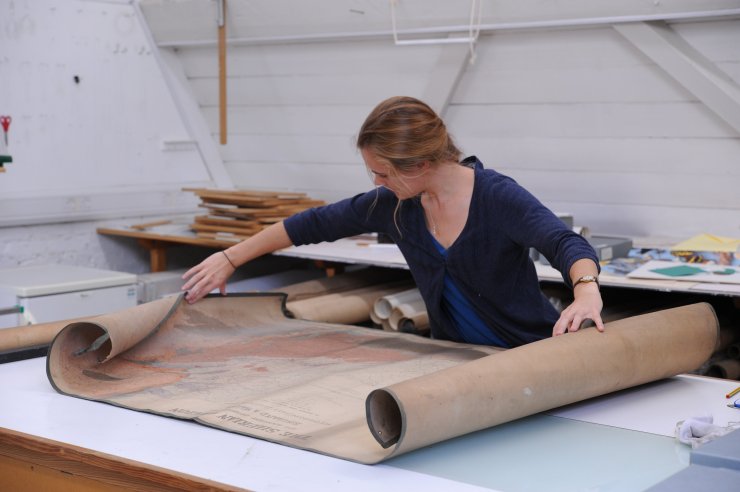
“At the start of my internship I worked in the Library archive with the more well-used material that is already collated and stored by author. But later I got the chance to sort through the archive of maps and charts that is hidden away in the old paper conservation studio.
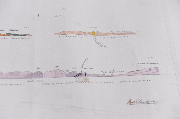
Excitingly, the first thing we pulled out was a signed map by Roderick Impey Murchison, produced between 1831 and 1838, depicting the Silurian region and adjacent counties of England and Wales – the first geological map produced of that region!
Murchison was a Scottish geologist who in 1831 started studying the greywacke rocks underlying the Old Red Sandstone at the border of England and Wales. He subsequently grouped them into a new order of succession, which he called the Silurian System, a period lying between the older Ordovician and younger Devonian periods, and with its own distinct organic remains and unique rock formations.
I later found three watercolours of numerous geological sections from the Lower and Upper Silurian, signed by Murchison but owned by William Buckland, Oxford’s first Reader in Geology.
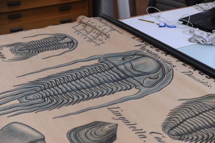
I’ve since encountered a whole array of maps of various parts of the world, from regional maps of the Nile basin in Egypt, to small parishes in the UK, through to maps of continents and the world, all dating between 1836 and 1924. Other finds in the archive have included numerous lecture diagrams depicting mainly fossil shells and trilobites from Silurian and Devonian rock deposits. These are in the style of English geologist John Phillips, who was William Buckland’s successor as Reader of Geology. Phillips may have used the displays as lecture aids during his time at the University, from 1853 to his death in 1874.
Most of the maps and charts are in need of some conservation care, including cleaning and storage in conservation-grade boxes. I have also been cataloguing them with descriptions so that they can be uploaded to the new content management system for later searching online. These descriptions include information on the author, date, and dimensions of an item, as well as an outline of its key features, language, location and condition.
However, the majority of the material has no associated authors or dates, so the next stage would be to trace their origins so that this information can be added.”
A job for another treasure hunter perhaps?
Cecilia Karlsson – EPA Cephalosporin Fund intern, 2014
Scott Billings – Public engagement officer

Published by